Lidar Systems Give Vision to Vehicles
Every lidar application requires connectivity. Choosing the right connectors starts with understanding the environment that the technology will operate in.
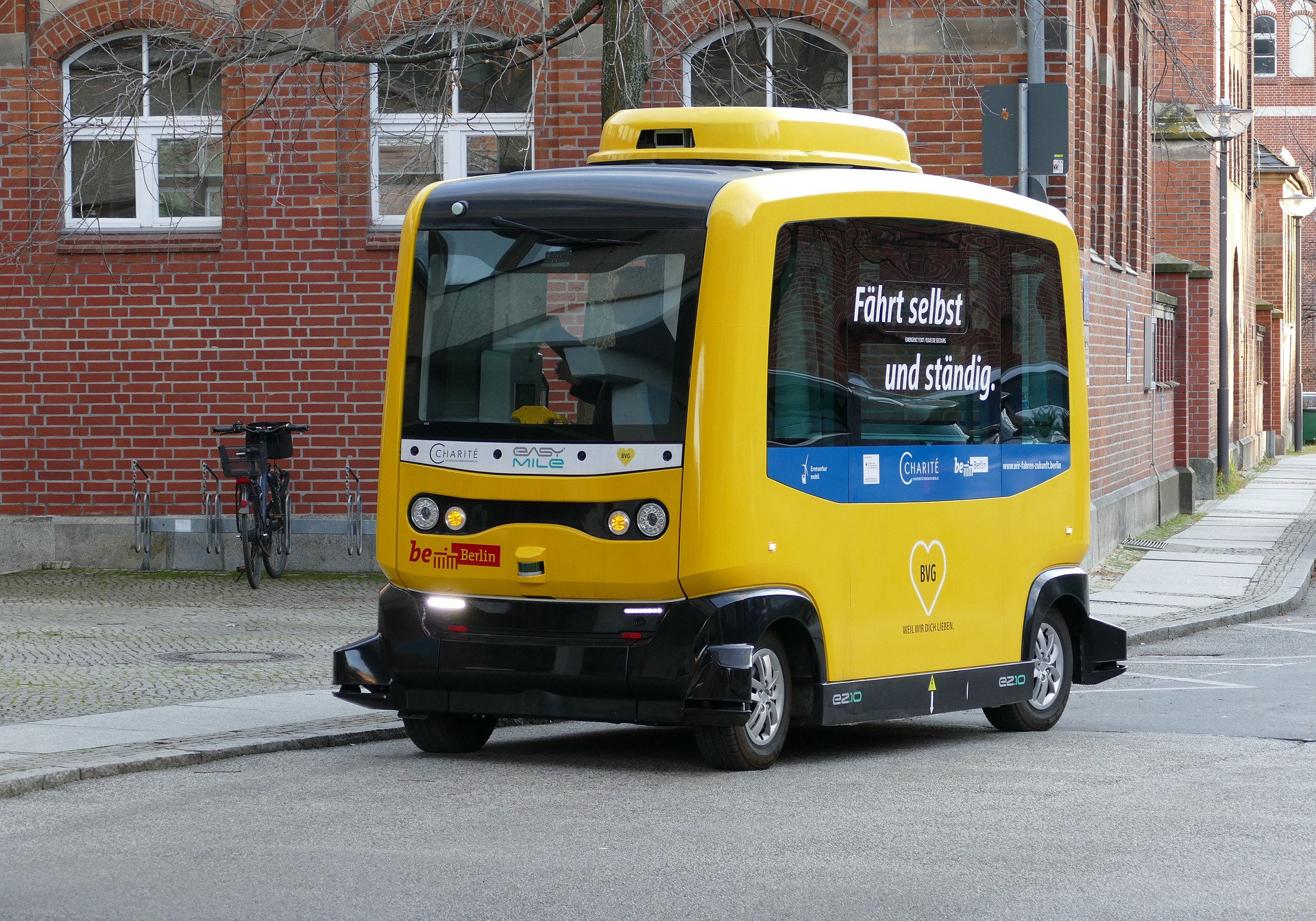
Lidar technology has grown into a highly competitive and rapidly evolving industry. Its use in vehicle applications has enabled systems like ADAS, autonomous transportation systems, and diverse applications ranging from traffic management and pedestrian monitoring to iPhones and even robot vacuums.
Lidar (light detection and ranging) systems include a laser scanner unit, a specialized GPS receiver, and an inertial management unit (IMU), aided by sensors, a phased array of antennas, microelectromechanical mirrors (MEMS), and other application-specific components. These are all united by — or contain — small, lightweight connectors.
Autonomous vehicle technology evolution centers around lidar’s capabilities. While fully autonomous vehicles are not yet ready for the roads, vehicles equipped with autonomous features are aiding drivers through enhanced safety, navigation, and mobility functions, including emergency braking, pedestrian and object detection, and collision avoidance. Unmanned autonomous vehicles are now in use in logistics and other industries.
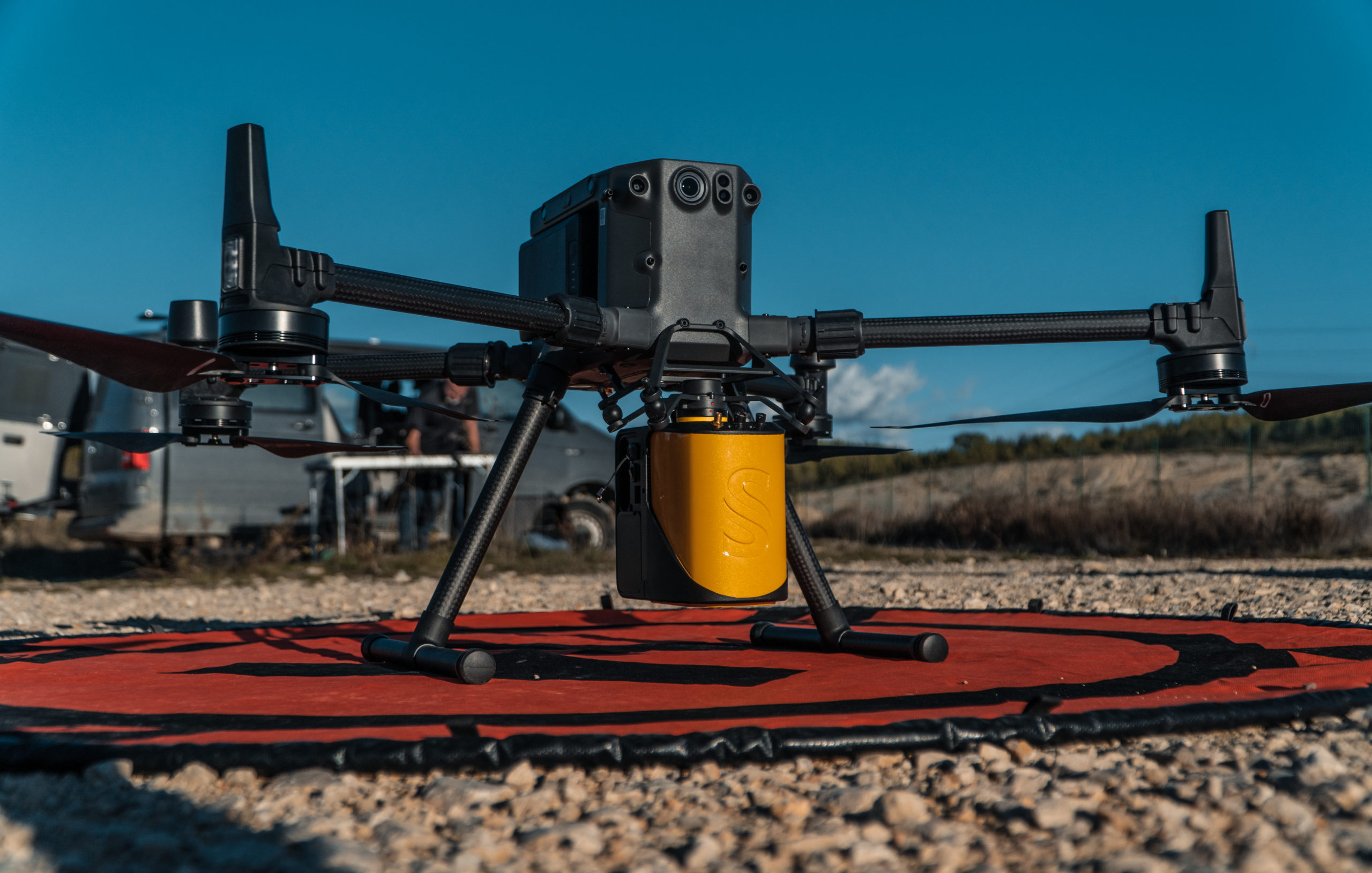
YellowScan’s Mapper mounted on a DJI M300
As unmanned aerial vehicles (UAVs) have advanced enough to cover large areas relatively quickly, multiple industries and disciplines have embraced the idea of combining lidar and UAVs to create a cost-effective, efficient, and reliable method of data-gathering and navigation. Tasks such as monitoring powerlines, surveying topography, forest management, and studying coastal erosion can be more easily accomplished with UAVs and lidar than by people on the ground. In addition, UAVs equipped with lidar allow users to see under vegetation or even underground, providing valuable data to construction companies, archeologists, and civil engineers.
YellowScan, based in southern France, makes lightweight UAV-lidar mapping solutions. This technology is accessible and cost-effective for small surveying operations, such as a survey of ruins, topographic studies of road and rail corridors, and an airborne survey of the Amazon in French Guyana that mapped both canopy and terrain to study the impacts of climate change.
Users must be able to mount the system on any type of platform, from the smallest to the largest UAV. This means the lidar device needs to be well-thought-out and easy to use. YellowScan uses proprietary software to process data and uses its own scanners and lidars from companies such as Velodyne, HESAI, Riegl, and Livox.
What is the role of connectivity in lidar?
Connectivity is used in lidar applications for real-time data transmission, external power implementation, and system communication. YellowScan offers two data transmission options. One captures data on a USB key. After the UAV completes its flight, users remove the USB key and plug it into a computer to view the data. With optional hardware and software, a connection to a live station provides real-time data. There is also a connection between the lidar and the antenna. This requires an SMA connector. The antenna is used for geo localization of the lidar sensor. An inertial measurement unit (IMU) is connected to the antenna. YellowScan’s engineers chose MiniMax from Fischer Connectors to meet their specific requirements.
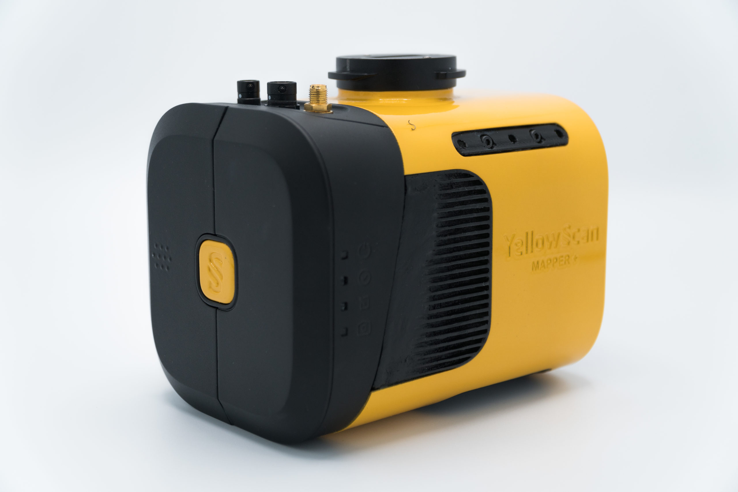
YellowScan devices each use three Fischer Minimax connectors. (Left to right) Four pins for the external power port; 24 pins (RJ45 and Universal Asynchronous Receiver Transmitter, UART) for the LiveStation port; and 19 pins (USB and General Purpose Input/Output, GPIO) for the optional camera port.
Suppliers that provide connectivity solutions design lidar components with a guiding range of requirements that blend size, weight, and power priorities with the precision functionality needed for the lidar unit to communicate with other elements in the connected system. Hirose Electric offers floating board-to-board connectors, FPC/FFC connectors, and interface connectors miniaturized to fit within lidar units used in vehicle systems. LEMO’s B Series circular connectors support lightweight lidar systems used in surveying technology. TE Connectivity’s motion and detection sensors provide data needed to guide applications like vehicles, robots, and UAVs and ensure optimal functionality in multiple systems.
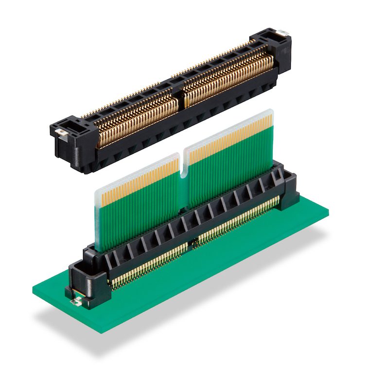
Hirose Electric’s FunctionMax connectors provide high-speed functionality to lidar systems. The FX27 Pitch Floating Card Edge Connector is a 0.8mm edge card connector with a mated height of 22.0 mm.
Key Requirements for Connectors Used in Lidar Systems
- Space and weight.
A small footprint and light weight are critical for connectors and other components used in UAV-based lidar systems. - Rugged material.
UAVs operate in extreme weather and components must be ruggedized to handle extreme high and low temperatures. - Vibration.
Drones vibrate a lot. All connectors must have reliable locking mechanisms and be well integrated for the lidar system to provide quality data. - Dust and rain.
If it begins to rain, the drone must land, but until then it has to remain functional. Connectors must be IP rated for water and dust ingress protection - Large pin count.
High pin density is necessary for maximizing performance without increasing the weight or size of the connector. - Electromagnetic Interference (EMI).
In all electronic systems, EMI can be an issue and connectors should be shielded to minimize that effect.
Like this article? Check out our other autonomous vehicle articles, our Transportation and Sensors and Antennas articles, plus review a full listing of our 2021 Articles.
Subscribe to our weekly e-newsletters, follow us on LinkedIn, Twitter, and Facebook, and check out our eBook archives for more applicable, expert-informed connectivity content.
- Construction Vehicles Go Electric - June 25, 2024
- Heavy Duty Product Roundup - June 25, 2024
- What are heat sinks? - June 18, 2024